
Treasure Hunter Underground Imaging Systems
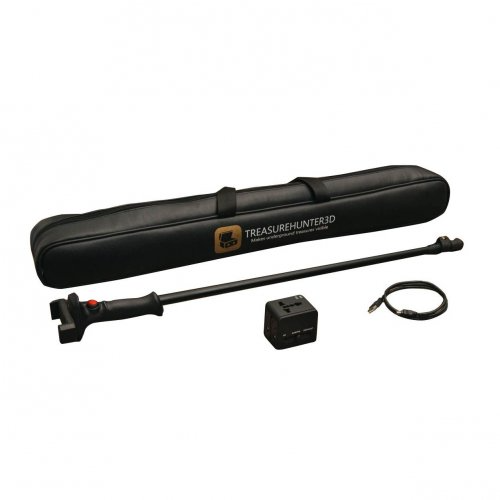
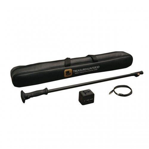
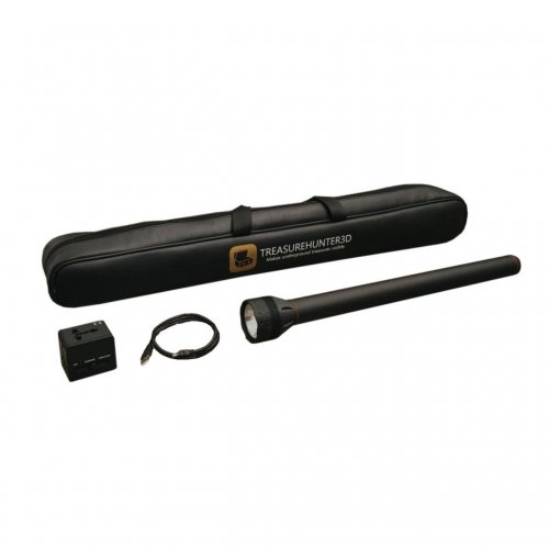
The Treasure Hunter underground imaging category brings together handheld TreasureHunter3D instruments and a drone-mounted sensor option. GoldenEye Plus, GoldenEye, TreasureHunter, TreasureLight and DroneRover offer different working arrangements. Choosing between them involves more than compact dimensions or the prospect of covering a large area quickly. The central issue is how measurements will be collected, positioned and retained for review.
Compare the portable sensor, mobile application, control device and, where relevant, drone platform as a complete arrangement. A handheld survey and an airborne survey do not share identical position and height conditions. This guide separates those workflows, explains package questions and helps you build a shortlist around the information you actually need. The recording process behind the three-dimensional display deserves as much attention as the display itself.
TreasureHunter3D GoldenEye, GoldenEye Plus and TreasureLight models
When comparing Treasurehunter3d GoldenEye and Treasurehunter3d GoldenEye Plus, check the application version and the functions available with the exact device. The manufacturer presents these families with different visualisation levels. Installing the same application does not mean that every connected instrument unlocks identical capabilities. During a demonstration, confirm which model is connected and whether the illustrated feature belongs to the package being offered.
For a compact option such as Treasurehunter3d TreasureLight, consider portability together with measurement handling. Carrying the instrument in a bag may be straightforward, while maintaining consistent sensor movement is a separate skill. Hand angle, height and movement at the end of a survey line can influence the recording arrangement. Try a short survey rather than judging usability only from dimensions or photographs.
The TreasureHunter listing can also be included in your comparison. First write down the functions you need: orderly scan recording, field review, file storage or later desktop analysis. Then confirm these tasks model by model. An attractive visual feature need not be essential if a simpler function is what allows you to collect and retrieve records reliably.
Treasure Hunter magnetic anomalies and 3D imaging
A three-dimensional result is not a photograph of the ground beneath you. This handheld TreasureHunter3D family is associated with measuring variations in the magnetic field. Displaying those changes in software does not amount to direct chemical analysis of an object's composition. When a result is described as gold or a cavity, ask which physical observation supports that interpretation and what other explanations remain possible.
Nearby fencing, vehicles, surface iron and natural variations in the ground can affect the context of an interpretation. Detecting a contrast and conclusively identifying its cause are different achievements. Advertised depths should not be applied to every target size and every site. Display colours alone do not prove the presence of a precious metal or a chamber with specific dimensions.
During a demonstration, request the area sketch, scan direction and sensor movement alongside the result. Repeating a measurement from another direction can help assess whether an observation relates consistently to the same place. Note any changed conditions. This makes the data collection process visible instead of asking you to rely on one successful-looking screen image.
DroneRover airborne surveys versus handheld measurements
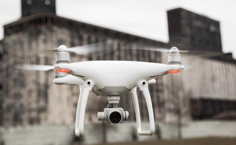
For Treasurehunter3d DroneRover Phantom 4 Pro, establish whether the sensor and drone are supplied together or separately. A drone model in a listing title does not guarantee that packages offered at different times contain the same equipment. Check flight application, phone or tablet compatibility, connections and accessories together. Distinguishing documentation for different versions is particularly important when planning an airborne workflow.
Sensor height, flight path and the association between measurements and positions all matter during airborne collection. A handheld operator directly manages the sensor's movement, whereas a drone survey adds the motion of the platform to the process. Covering more ground does not automatically produce greater detail. The flight plan, recording arrangement and site conditions must be evaluated together.
An open, orderly practice area makes initial learning easier. Check sensor connection, position information, recording status and successful file storage separately. Follow the platform's operating requirements and manufacturer instructions. An initial airborne record may help identify a smaller area for ground-based follow-up, but compare the conditions before treating the two datasets as equivalent measurements.
TreasureHunter3D applications and survey file storage
A phone or tablet needs to do more than establish a connection. Screen visibility, battery planning, available storage and physical support during operation all affect usability. Ask for a connection and sample-file demonstration using the device you intend to carry. Compatibility described for a handheld application should not automatically be extended to DroneRover flight control.
Use understandable file names. In addition to date, area reference and scan direction, record whether the measurement was handheld or airborne. Keep the flight and height notes for an airborne record and the sensor arrangement for a handheld one. When sharing a screenshot for review, identify the original file from which it was produced so that the underlying data can be located later.
Include file transfer in the demonstration. Learn which desktop tools can open a mobile record and which details are retained. Check current analysis-software compatibility against your device version. For a long-term archive, original records are generally more useful than a folder containing only processed images whose settings and dimensions are no longer known.
Treasure Hunter detector prices and package contents
Compare handheld detector prices separately from the total requirements of a drone system. A sensor price may not represent the cost of the complete operating platform. Identify which phone, tablet, aircraft, batteries and analysis tools you already have and which would be additional requirements. Review the current product record together with a written quotation to establish a consistent scope.
| Option group | Priority check | Budget question |
|---|---|---|
| GoldenEye and GoldenEye Plus | Application functions available to the model | Sensor and software scope |
| TreasureHunter and TreasureLight | Handling and repeatable collection | Controller and accessory requirements |
| DroneRover | Platform, connection and application compatibility | Sensor-only versus drone package |
| Data review | Archiving and desktop transfer | Included analysis tools |
A product listing does not, by itself, establish immediate availability or delivery time. Confirm the complete package name, version and supply conditions before ordering. Ask what training covers: connection, initial recording, repeat surveys and transfer are distinct parts of a useful session. These questions distinguish receiving an instrument from having a workable process for using it.
Which Treasure Hunter imaging device is best for you?
The best choice depends on the sites you can access and the survey process you can manage. Handheld checks in smaller areas may suit an operator who frequently moves between locations. Airborne preliminary coverage introduces platform management, positioning and a plan for ground follow-up. Greater coverage is not automatically a better choice for every user, particularly if the resulting records cannot be interpreted consistently.
Reviewing the broader underground imaging systems category can help define the kind of evidence you need. Request a demonstration resembling your intended conditions. Follow the beginning of the measurement, completion of the file and reopening of the result. Base the decision on a practical routine you can maintain rather than on the model name or a single depth claim.
Write a short working plan before selecting a package: where will measurements take place, which platform will be used, how will records be labelled and how will an uncertain area be checked again? These questions clarify the equipment requirement and identify where training is needed. They also make competing offers easier to compare because each seller is answering the same practical brief.
For a first practice session, keep the area modest and document one complete attempt before changing the setup. Record why a second attempt differs, whether through height, direction or handling. A clear sequence of observations is easier to learn from than a large collection of unlabelled images. This discipline remains useful whether the sensor is carried by hand or supported by a drone.
Frequently Asked Questions
Are all products in this category used with drones?
No. GoldenEye, GoldenEye Plus, TreasureHunter and TreasureLight are handheld options. DroneRover involves a separate platform and operating arrangement.
Do GoldenEye and GoldenEye Plus have identical application features?
Functions can depend on the model and software version. Confirm that the demonstrated feature is available with the device you intend to buy.
Does the DroneRover price include a drone?
Check whether the quotation covers a sensor-focused package or a complete drone bundle. The title alone is not a definitive delivery list.
Does a magnetic anomaly mean gold is present?
No. Magnetic variation can have several causes. A response or colour does not chemically identify gold.
Can the handheld application also control a drone survey?
Do not assume this. DroneRover platform, operating-system and flight-application compatibility must be verified separately.