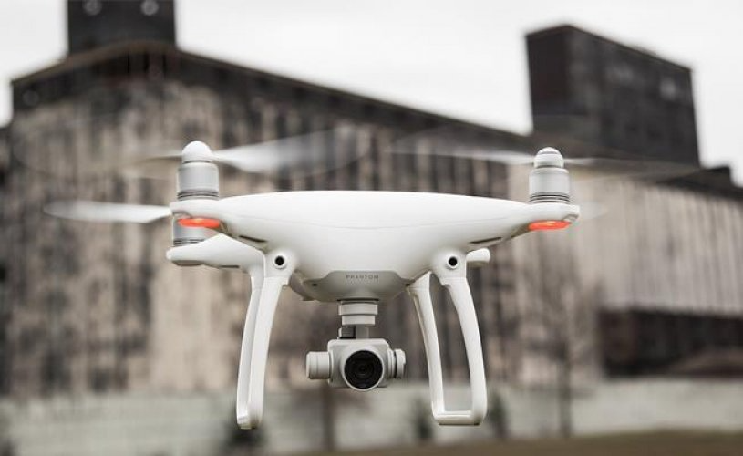
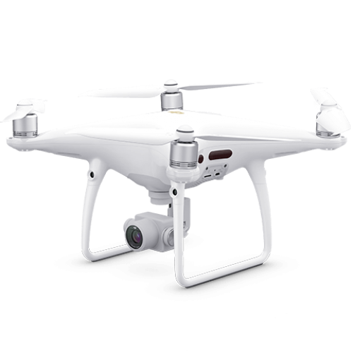
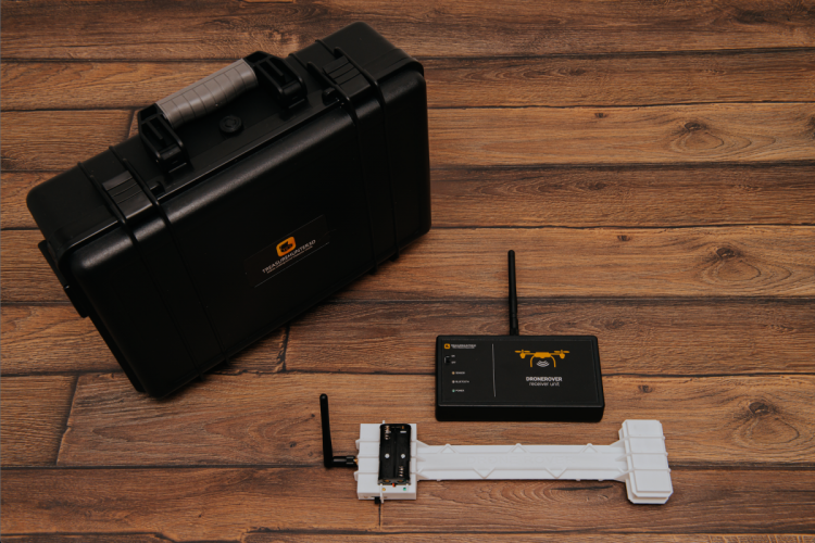
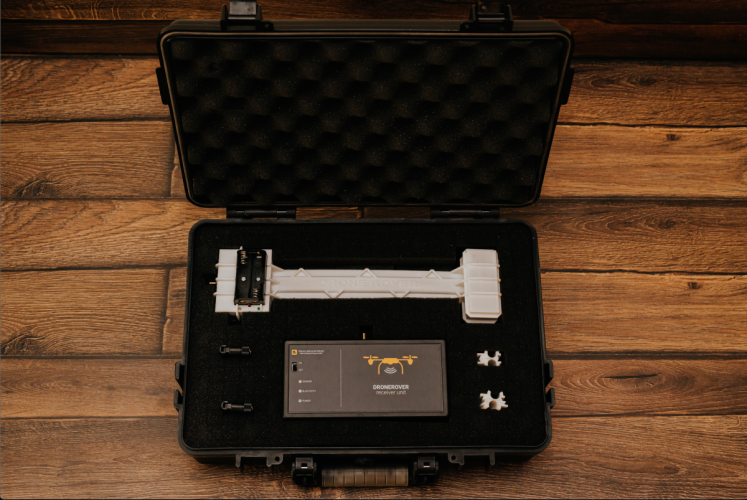
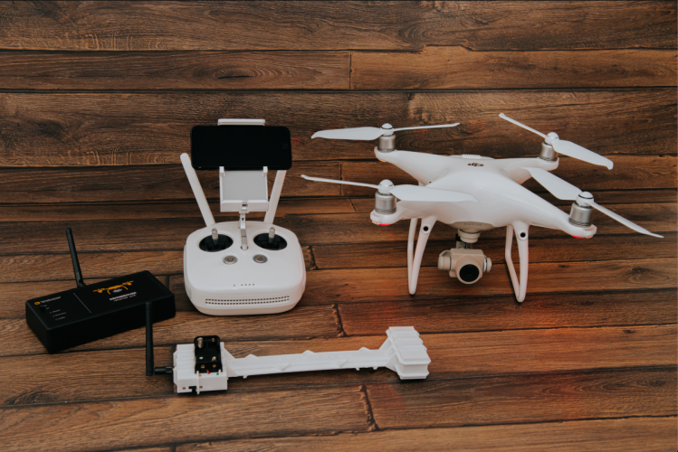
Treasurehunter3d DroneRover Phantom 4 Pro
Free Shipping
Free shipping on orders over 500 TRY
24/7 Support
Support service between 08:30 - 22:00
Expert Training and Field Support
We provide expert training and field support service.
Description
Treasurehunter3D DroneRover Phantom 4 Pro is a powerful drone system designed for use in professional field work. With its advanced imaging and sensor technologies, it performs tasks such as land scanning, 3D mapping, photography and video shooting with high precision. It stands out with its data collection performance, especially in treasure searches, geophysical field studies, land analyzes and research projects.
Advanced Flight and Sensor Technology
- Stable flight with high sensitivity GPS module
- Obstacle detection and collision avoidance systems
- Strong wind resistance and long flight time
- Remote control and telemetry support
- Automatic takeoff, landing and route planning
High Resolution Imaging
- 4K video recording and high-resolution photo capture
- Clear image with gimbal stabilization system
- Portrait and landscape shooting modes
- Detailed imaging with wide dynamic range
- Ground data collection and mapping support
Usage Areas
- Treasure searches and field surveys
- Geological and geophysical research
- Terrain mapping and 3D modeling
- Land investigation and analysis projects
- Archaeological field studies
- Fast imaging of large areas
Technical Specifications
- Camera: 4K / high resolution photo and video
- Gimbal: 3-axis stabilization
- GPS: Precise positioning system
- Battery: battery that provides long flight time
- Obstacle Detection: Automatic collision avoidance with environmental sensors
- Control: Remote control and mobile app support
- Flight Modes:Automatic route planning, steady flight, manual control
- Weight: Field portable drone platform
Frequently Asked Questions (FAQ)
It is a high-performance drone system designed for professional field surveys, imaging and data collection.
It can be used in many areas such as treasure searches, geological field studies, land mapping and research projects.
Provides 4K video and high-resolution photo shooting; Provides clear images with gimbal stabilization.
Provides long-term flight depending on battery capacity (varies depending on model configuration).
Yes; Captured images and videos can be stored and used for analysis.
Provides wind resistance and stable flight with its professional grade engine and GPS system.
Yes; It is suitable for mapping and 3D modeling with land imaging data.
Suitable for land surveyors, geophysicists, treasure seekers and field researchers.
Treasurehunter3D DroneRover Phantom 4 Pro is a powerful and reliable drone solution for field surveys, terrain analysis and professional imaging tasks. It provides superior performance with 4K imaging and advanced control features.
Installment Options
Related Products
Discover similar and complementary products selected for you.

Fast Shipping
All detector models are shipped with fast and secure cargo.
Precise Search
Advanced technology finds precious metals hidden deep underground.
High Quality
Professional quality, durable and long-lasting devices.
Easy to Use
Easy to use for both beginners and professionals.