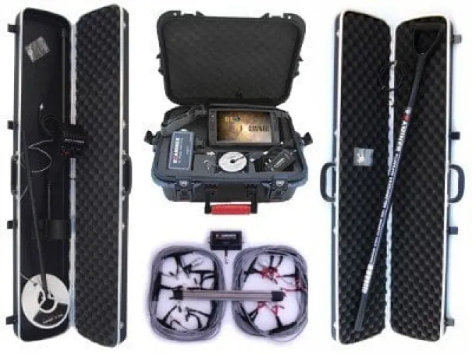
Geo Examiner Standard Package
Free Shipping
Free shipping on orders over 500 TRY
24/7 Support
Support service between 08:30 - 22:00
Expert Training and Field Support
We provide expert training and field support service.
Description
Geo Examiner Standard Package is a powerful field imaging system that analyzes underground layers in 2D/3D by combining radar and electromagnetic scanning technologies. Detects metal targets as well as cavities, tunnels, graves, cables, pipes and other underground structural anomalies. The standard package is suitable for both hobbyist and professional users, with sensors and a user-friendly control panel optimized to meet basic field analysis needs.
Underground Imaging Technology
- Visual analysis of underground layers with radar-based signal processing
- Detect metallic targets with electromagnetic detection
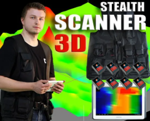
- 2D and 3D underground layer imaging
- Showing depth layers with color maps
- Real-time data streaming and display
Multiple Scanning Modes
- 2D Imaging: Analyzing underground layers on a horizontal plane
- 3D Imaging: Showing underground layers in three dimensions with depth and location information
- Metal Detection Mode:Locating the location of metal lines, cables and pipes
- Cavity/Anomaly Mode: Detection of cavities such as caves, tunnels and graves
- Live Scan: Monitoring real-time data in the field
User-Friendly Design and Controls
- Clear, easy-to-read screen interface
- Intuitive menu and control keys
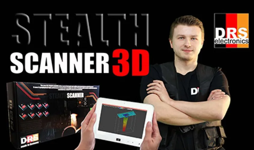
- Advanced analysis opportunity with tablet/PC connection support
- Recordable data — subsequent detailed review
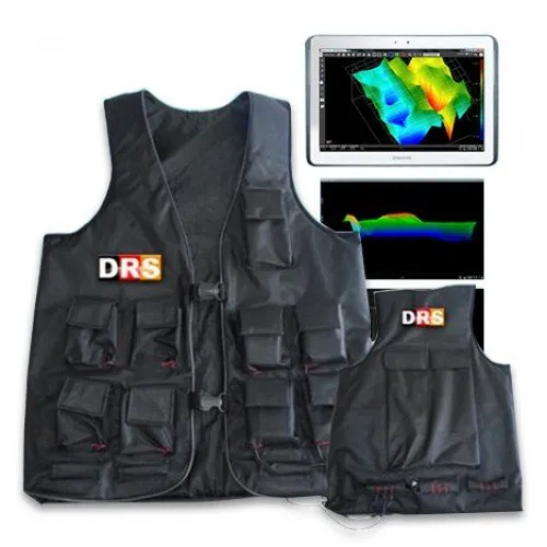
- Ergonomic and field-oriented portable design
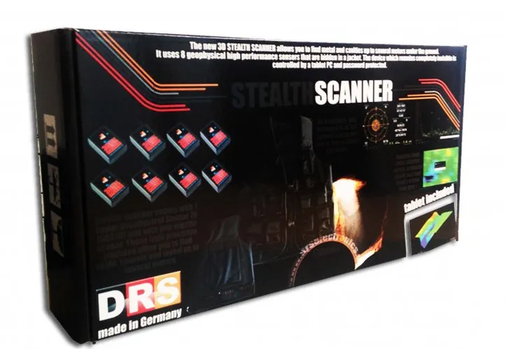
Standard Package Content
- Radar + electromagnetic scanning unit
- Metal detection sensors
- Live Scan real-time imaging support
- Tablet/PC connection cables
- Rechargeable battery and charging unit
- User manual
- Protective carrying case
Technical Specifications
- Scanning Technology: Radar + electromagnetic detection
- Imaging: 2D and 3D analysis
- Depth: Visual mapping at different layer levels
- Display: Tablet/PC high definition display
- Data Logging: Saving signal and image data
- Battery: Long field work opportunity
- Controls: User-friendly menu + key interface
Usage Areas
- Detection of underground structures such as cavities, graves and tunnels
- Determination of metal infrastructure elements (pipe, cable, water line)
- Archaeology and pre-drilling surveys
- Geological and geophysical field analyzes
- Treasure searches and field studies
- Geotechnical and pre-construction evaluations
Frequently Asked Questions (FAQ)
It is an underground imaging system that combines radar and electromagnetic detection technologies; Detects metal, void and other structural targets with 2D/3D analysis.
While radar signals visually analyze underground layers, electromagnetic sensors detect the location of metallic targets.
While 2D shows a simple horizontal layer section, 3D provides three-dimensional analysis with more detailed depth and target location information.
The device can present a basic image on its own screen; However, connection to PC/Tablet enables more advanced analysis and data recording.
Yes; can visually analyze different underground layers according to their depth levels.
The combination of radar and electromagnetic provides more balanced and clear results in mineralized grounds.
Yes; Field data can be recorded and detailed analysis can be made later.
Suitable for geophysical engineers, archaeologists, treasure hunting teams and advanced field users.
Geo Examiner Standard Package is an underground imaging solution that combines radar and electromagnetic technologies. It provides detailed and reliable results in field work with 2D/3D analysis and metal detection.
Installment Options
Related Products
Discover similar and complementary products selected for you.
Fast Shipping
All detector models are shipped with fast and secure cargo.
Precise Search
Advanced technology finds precious metals hidden deep underground.
High Quality
Professional quality, durable and long-lasting devices.
Easy to Use
Easy to use for both beginners and professionals.