


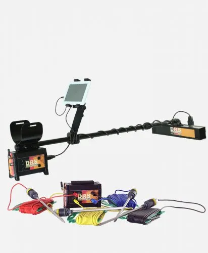
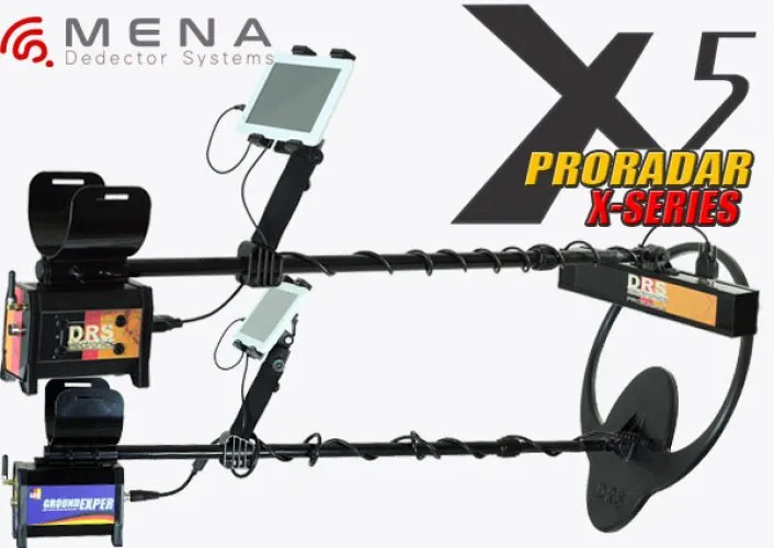
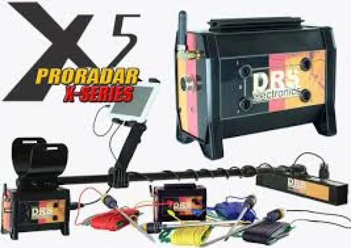
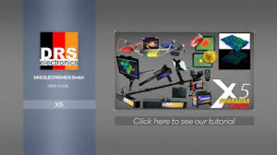


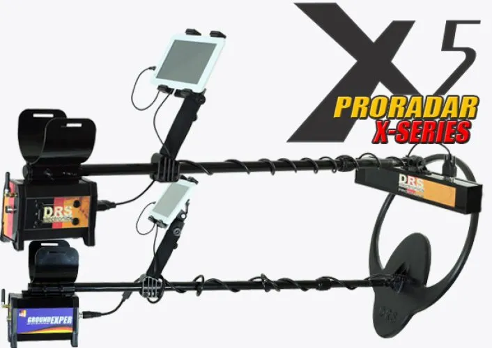
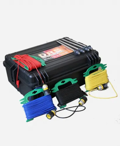
DRS ProRadar X5
Free Shipping
Free shipping on orders over 500 TRY
24/7 Support
Support service between 08:30 - 22:00
Expert Training and Field Support
We provide expert training and field support service.
Description
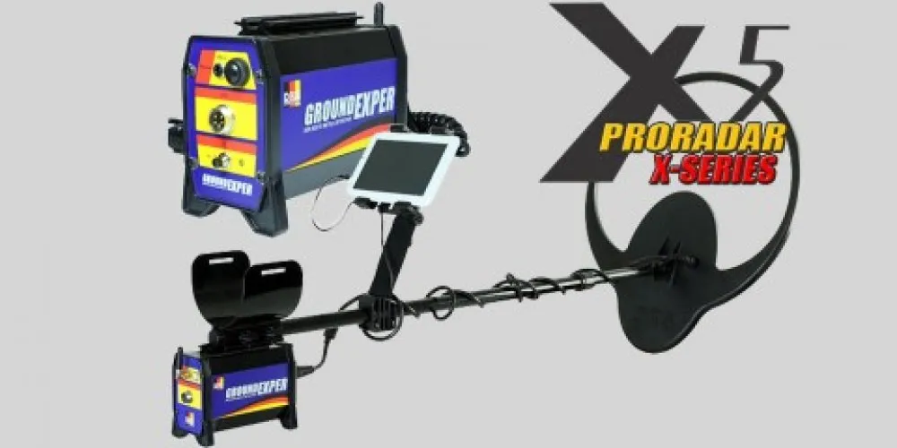
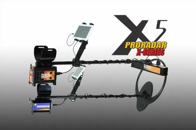
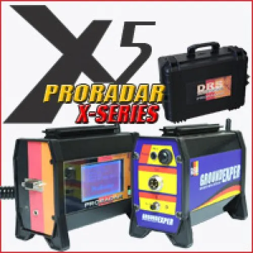
DRS ProRadar X5 Underground Imaging System is a professional scanning device that combines advanced 3D radar scanning and underground analysis technologies. This system can show metal targets, cavities, tunnels, graves, underground structures and other anomalies with detailed technical imaging; It offers high resolution and reliable results in field work. It is suitable for geophysical research, archaeological surveys, treasure searches and underground infrastructure detection.
Advanced 3D Radar Imaging Technology
- Three-dimensional (3D) underground layer analysis
- Visualizing depth layers with color radar maps
- Detection of metal signals and void/distortion zones
- High resolution signal processing
- Target scanning at different depth ranges
Multiple Scanning Modes
- 3D Viewing: Shows radar data as a three-dimensional panoramic map
- 2D Layer Analysis: Presents underground layers as a 2-dimensional cross-section
- Metal Detection Mode:Indicates location and density of metal targets
- Void / Anomaly Mode: Detects gaps such as tunnels, caves, graves
- Live Scan: Live scanning with fast real-time data stream
User-Friendly Controls and Display
- Easy-to-read screen interface
- Widescreen 3D analysis with PC/Tablet connection support
- Intuitive use with simple menu structure
- Data recording, playback and reporting support
- Portable and field-oriented ergonomic design
Technical Specifications
- Scanning Technology: 3D radar imaging
- View: 2D and 3D subsurface layer maps
- Depth: Detailed scanning in different ground layers
- Display:Tablet/PC high definition display
- Data Logging:Storing and analyzing signal and radar data
- Battery: Long field operation battery
- Weight: Light and portable system
- Controls: User-friendly menu + graphical interface
Usage Areas
- Deeply buried metal target searches
- Detection of cavities, tunnels, caves and graves
- Geophysical and geological field analyzes
- Archaeological surveys
- Infrastructure (pipe, cable, installation) location analysis
- Professional treasure and field work teams
Frequently Asked Questions (FAQ)
It is a professional scanning system that visually analyzes underground layers in detail with 3D radar imaging technology.
It shows underground layers in a three-dimensional graphical way with radar signals; It detects metal and voids/anomalies.
While 2D provides simple horizontal cross-sectional images, 3D displays depth and location information in three dimensions; In this way, the form and depth of the target can be understood more clearly.
Yes. All radar data can be recorded and analyzed and reported later.
The device can perform basic browsing on its own screen; However, a larger screen and advanced analysis are possible with PC/Tablet connection.
Yes. Thanks to radar scanning, target search can be made at different depths; It offers depth analysis that varies depending on the ground structure.
Radar-based technology is less affected by mineralized ground; This provides a more stable image in harsh conditions.
Suitable for geophysical engineers, archaeologists, professional treasure hunters and advanced field researchers.
DRS ProRadar X5 Underground Imaging System is a professional field scanning device that allows you to analyze the underground in detail with 3D radar technology. It provides reliable results with deep analysis and high resolution performance.
Installment Options
Related Products
Discover similar and complementary products selected for you.
Fast Shipping
All detector models are shipped with fast and secure cargo.
Precise Search
Advanced technology finds precious metals hidden deep underground.
High Quality
Professional quality, durable and long-lasting devices.
Easy to Use
Easy to use for both beginners and professionals.