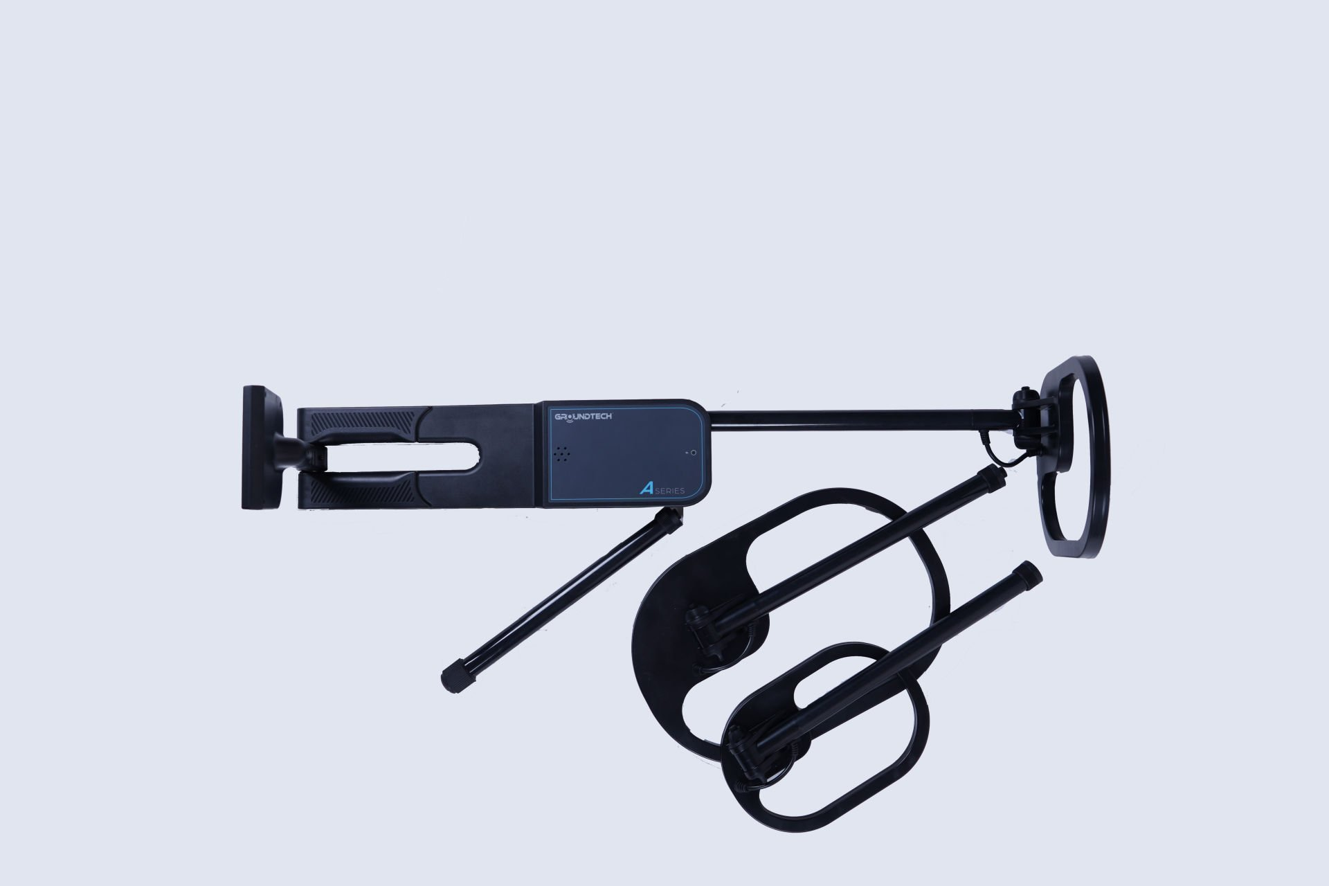
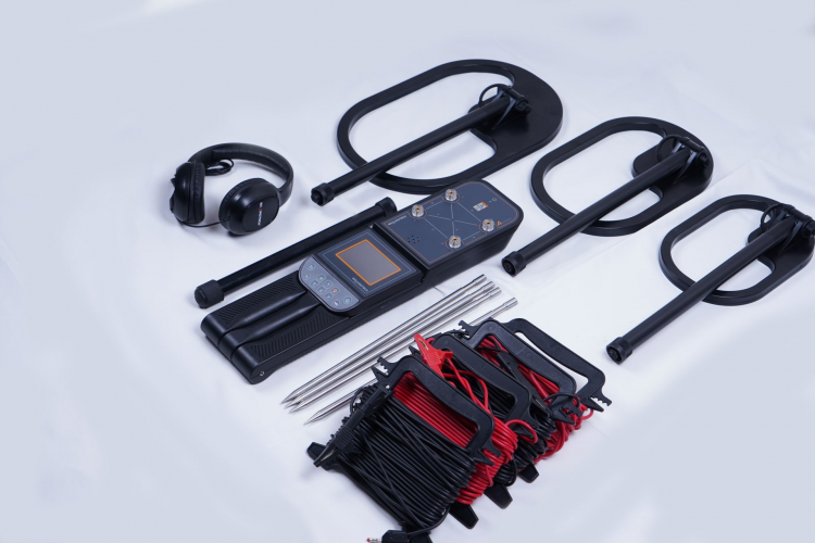
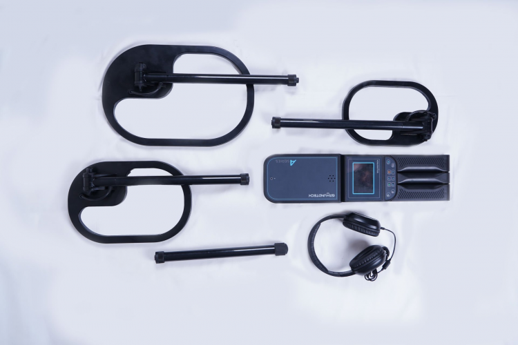
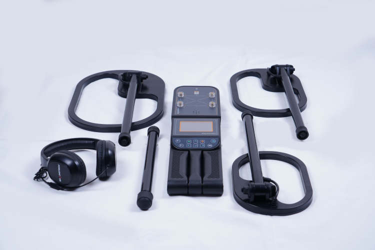
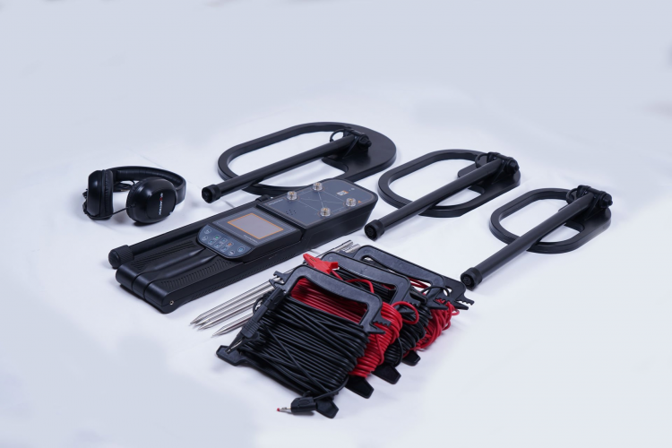
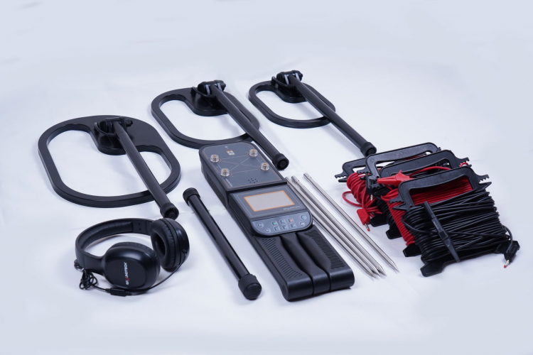
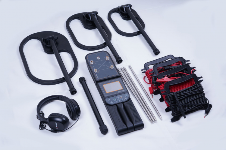
Conrad Groundtech A2-GEO Series
Free Shipping
Free shipping on orders over 500 TRY
24/7 Support
Support service between 08:30 - 22:00
Expert Training and Field Support
We provide expert training and field support service.
Description
Conrad Groundtech A2-GEO Series Underground Imaging Systems is an advanced scanning family that scans underground layers with high resolution by combining radar and signal analysis technologies. This series offers the ability to visualize metal targets, cavities, tunnels, tombs and other underground anomalies in 2D and 3D. It is suitable for geophysical field studies, archaeological research, infrastructure detection and professional treasure searches.
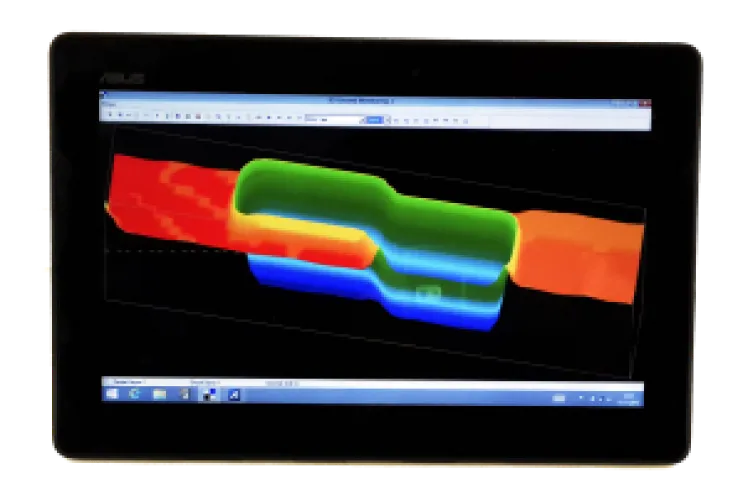
Underground Radar Imaging Technology
- Sending and analyzing signals to underground layers with different radar frequencies
- 2D and 3D radar imaging support
- Visualizing depth layers with color maps
- Detection of metal targets and void/anomaly areas
- Target discrimination with advanced signal processing algorithms
Multiple Scanning Modes
- 2D Visualization: Showing underground layers as horizontal sections
- 3D Imaging:Presenting depth and location information with a three-dimensional radar map
- Metal Detection: Location and density detection of metallic objects
- Cavity/Anomaly Mode: Detection of cavities such as caves, tunnels and graves
- Live Scan: Monitoring real-time field data
Series Advantages
- Possibility to choose according to user needs with different A2-GEO models
- Both shallow and deep scanning capability with wide radar frequency range
- Upgrade sensors and equipment when needed, thanks to modular design
- Advanced data processing and rapid production of results in the field
- Intuitive use with user-friendly interface
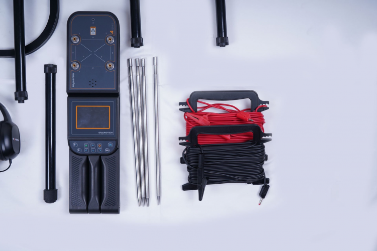
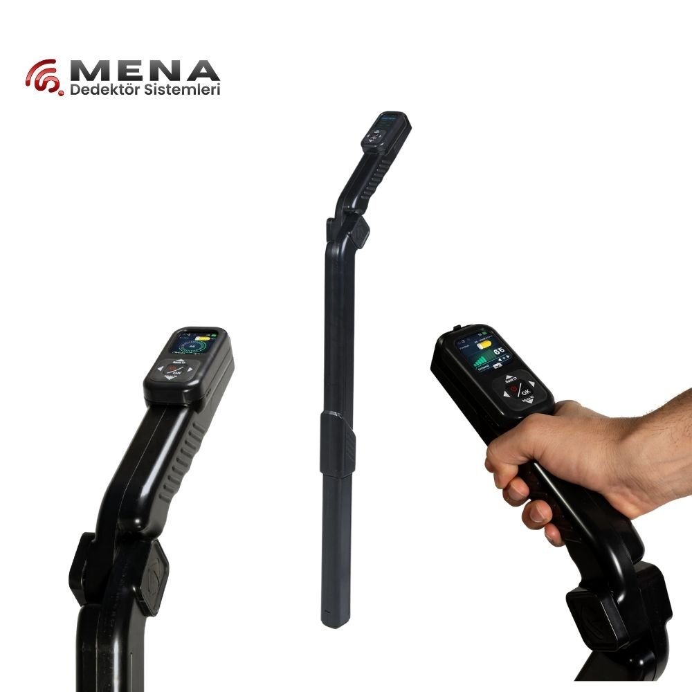
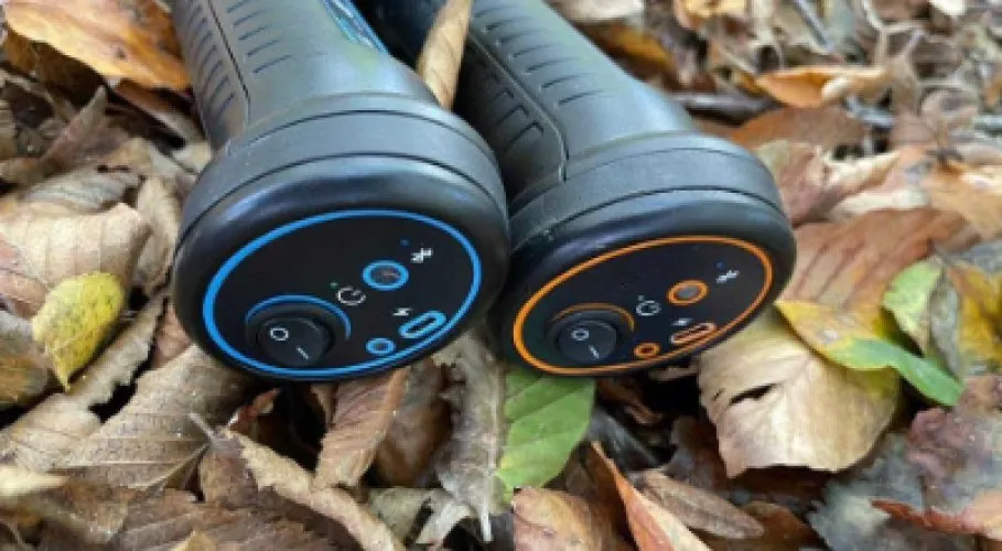
User-Friendly Controls and Display
- Clear, easy-to-read screen interface
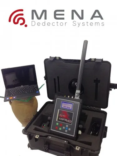
- Widescreen analysis with PC/Tablet connection support
- Intuitive menu structure and control keys
- Data recording, playback and reporting features
- Portable and field-oriented ergonomic design
Technical Specifications (A2-GEO Series)
- Detection Technology: Radar-based underground imaging
- View: 2D and 3D radar layer maps
- Depth:Target scanning at different ground levels with radar signals
- Display: Tablet/PC high resolution visualization
- Data Logging:Storing and analyzing signal and radar data
- Battery: Battery support for long field work
- Weight: Lightweight field portable system
- Controls:User-friendly menu with graphical interface
Usage Areas
- Underground metal target searches
- Detection of cavities, tunnels and caves
- Geophysical and geological field analyzes
- Archaeological surveys
- Location of infrastructure elements (pipe, cable, water line)
- Professional treasure searches and field team work
Frequently Asked Questions (FAQ)
It is a scanning device series that combines radar-based underground imaging and signal analysis technology.
It scans the underground layers with radar signals and clearly shows void/anomaly areas as well as metal targets.
While 2D provides a horizontal layer image, 3D displays depth and location information with a three-dimensional graphic.
Yes; Scanning data can be recorded and analyzed and reported later.
The device can perform basic viewing on its own screen; However, more detailed analysis is possible with a PC/Tablet.
Yes; Different A2-GEO models can perform deep scanning with different radar frequencies.
The radar-based system is less affected by mineralized ground and provides more stable imaging.
Suitable for geophysicists, archaeologists and professional treasure seekers.
Conrad Groundtech A2-GEO Series is a comprehensive scanning solution that combines radar-based underground imaging and signal analysis technology. It provides detailed results in field studies with 2D/3D analysis and advanced signal processing.
Installment Options
Related Products
Discover similar and complementary products selected for you.
Fast Shipping
All detector models are shipped with fast and secure cargo.
Precise Search
Advanced technology finds precious metals hidden deep underground.
High Quality
Professional quality, durable and long-lasting devices.
Easy to Use
Easy to use for both beginners and professionals.